Showing results 1 - 12 of 12
Image
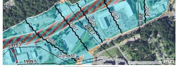
A FIRM will identify specific SFHAs (colored and hatched areas) and localized BFEs (wavy black lines)
Image
Dry wells are underground tanks that store water to percolate or drain slowly to another site or sewer.
Image
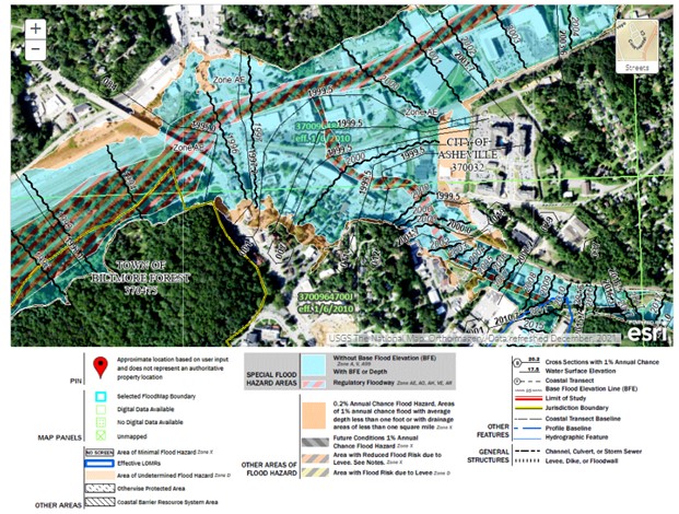
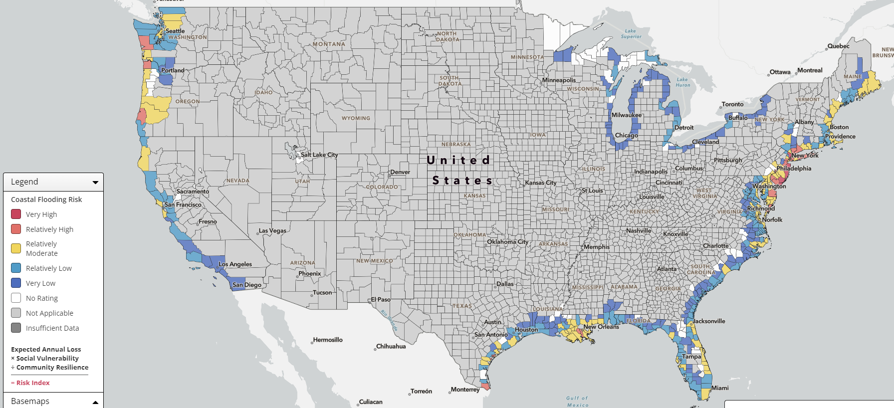
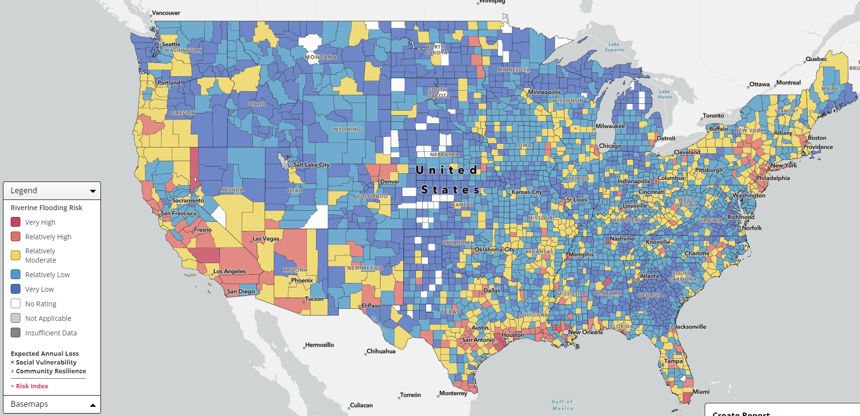
Flood hazard risk for a particular location can be assessed by viewing flood maps on the NFHL Viewer
Image
Image
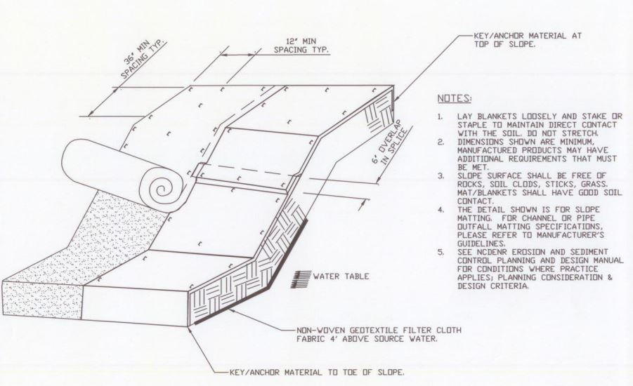
Installation of an erosion control blanket to minimize soil loss on sloped ground that has no established vegetation
Image
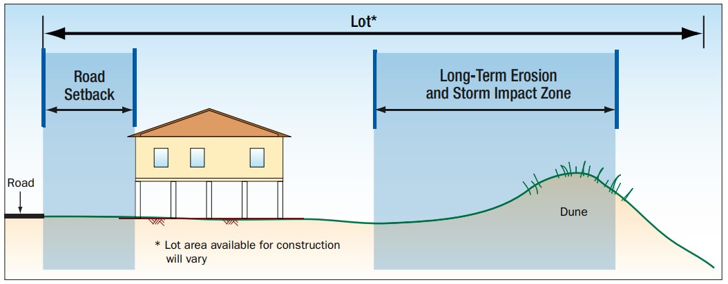
On ocean-front lots set the home as far back on the lot as possible, preferably with a protective dune between structures and shoreline.
Image

Soil types include sand, silt, and clay- the more sand, the more quickly the soil drains.
Image
Image
Image
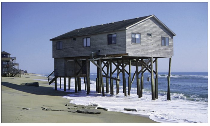
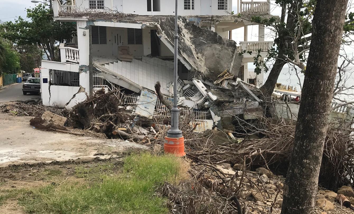
The pilings for this building are showing signs of failure due to a poor siting decision to locate the home too close to the surf.
Image

This home was incorrectly sited and supported too near a slope consisting of unstable soils.
Image
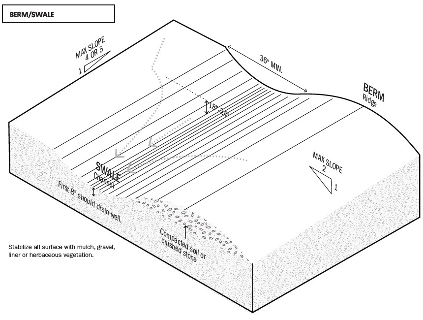
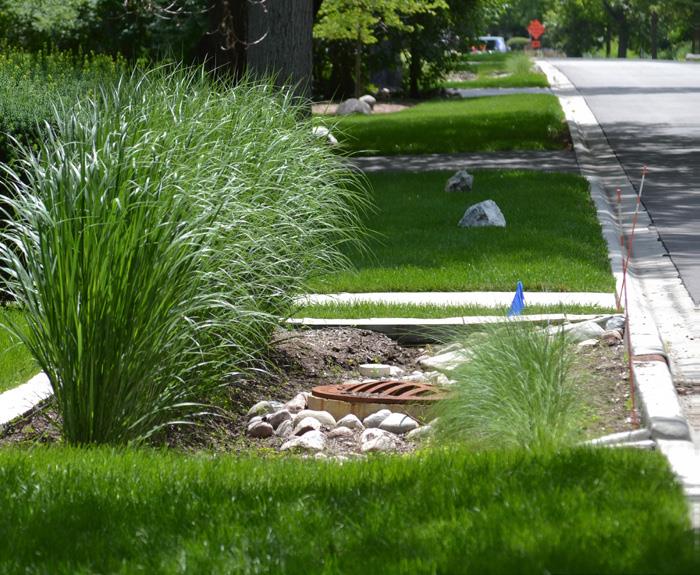
This swale and berm slow the flow of stormwater across a site to minimize erosion.